- All
- African projects
- assessment
- assessment selected projects
- Assessment selected projects 2
- Assessment selected projects 3
- Assessment selected projects 4
- ASTRA
- Cost Benefit Analysis
- Electric mobility and ITS
- Local Public Transport
- MOMOS
- planning
- planning selected projects
- planning selected projects 2
- planning selected projects 3
- planning selected projects 4
- planning selected projects 5
- projects
- Railways projects
- research
- research selected projects
- research selected projects 2
- research selected projects 3
- studies
- studies selected projects 1
- studies selected projects 2
- studies selected projects 3
- studies selected projects 4
- studies selected projects 5
- TRTingegneria
- TRUST
- urban mobility
- Sustainable Urban Mobility Plan (SUMP) of Bergamo (Italy) and related SEA With 120,000 residents, Bergamo is the fourth largest city in Lombardy. According to the origin-destination survey carried out by Regione Lombardia in 2014, 366,000 journeys daily affect the municipal territory. The drafting of the SUMP of Bergamo guaranteed consistency with the methodology suggested by the European Commission (www.eltis.org) and with the guidelines issued by the Italian Ministry of Transports (Decree 4 August 2017). Started in July 2018, the work has been organised in four phases:: background analysis of the mobility-related framework and its environmental, social and economic impact in Bergamo; evaluation of the current scenario (diagnostic framework and SWOT analysis) and subsequent definition of the general and specific objectives system as well as measurement indicators; elaboration of the SUMP, including the identification of alternative scenarios, the selection of the related policies and measures, the preparation of a monitoring plan for the ex post evaluation of the plan; acceptance and approval process. The plan has been prepared with the support of a traffic simulation model thus allowing for a detailed technical, environmental and economic evaluation. A tool for strategic evaluation (MOMOS, entirely developed by TRT) has been also used. A fundamental element of the SUMP has been the participatory process, which has included a survey on mobility habits addressed to those who live, work and study in Bergamo and four thematic focus groups. The sustainability of the SUMP has been supported by a Strategic Environmental Assessment (SEA) and an assessment of the effects of the Plan for the naturalistic Site of Community Importance (SCI) named «Boschi dell’Astino e dell’Allegrezza». The SUMP of Bergamo has been accepted by the City Council on 16/05/2019 and eventually approved om 05/07/2022. For more information Documents available on comune.bergamo.it (only available in italian) “Sustainable Urban Mobility Plan for Bergamo and its functional area”. Case study published on Eltis Platform
- Isola della Scala Intermodal Terminal– Feasibility study TRT has carried out an analysis to assess the feasibility for implementing an intermodal terminal in the Municipality if Isola della Scala. This has included the definition of the requirements for both rail and road logistics areas as well as the actual mode of operation of the terminal area. In particular, the assessment has included: The road accessibility to the terminal areas within the surrounding road network The rail accessibility to the terminal areas by the existing railway line aside the terminal and the operation mode for manoeuvring the rolling stocks for routing them on the network An estimation of both logistics and storage areas based on daily terminal operations of intermodal transport units The study included the impact assessment of terminal operations on road traffic, in particularly it has been considered a daily flow of 30 couple of train of 750m (mainly made by semitrailer and swap bodies) An estimation of the investments costs to set up the intermodal terminal, including the related costs for adapting the existing road and rail network, has also been made
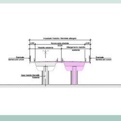
- Technical and economic feasibilty assessment. Upgrading measures for existing road and new road sections for the IV Stretch From Vaglio industrial area to the junction with S.P. Oppido S.S. 96 The project is part of the broader plan for the Salerno – Potenza – Bari Route, which was included in the First Program of Strategic Infrastructures approved by the Interministerial Committee for Economic Planning (CIPE) with the resolution n°121/2001. More in detail the object of the study is a portion of the IV Stretch “Zona industriale Vaglio – SS96 BIS – Inizio Variante di Gravina”, that is supposed to be 20 km long with a C1 section, as classified by the standards imposed by the D.M. 5/11/2001, and includes: A newly built stretch from S.S.407 «Basentana» to SP123, North of Tolve, in which a tunnel is planned Upgrading works for S.P.123 from North of Tolve to the junction with S.S.96 bis, near Oppido Lucano. The objective of the Technical Economic Feasibility Study is to find a design solution compatible with the financial resources allocated in the tender documents. For this assessment, TRT Trasporti e Territorio, in collaboration with GPI Ingegneria, is in charge for developing a traffic study, with the support of PTV Visum software, and a cost-benefit analysis. The modelling activities include: Current state network build-up Model parameters updating O/D demand matrices estimation and correction through mathematical correction procedure Validation of assigned vehicle flows with up-to-date traffic counts; Development of project scenarios to assess and compare their performances.
- Sustainable mobility territorial system within the MIBACT Salento Arco Ionico project The study is part of a wider project focused on the promotion and valorisation of tourism and cultural heritage in 12 municipalities located along the jonian coast of the Province of Lecce. The project is funded by the Italian Ministry of Cultural Heritage and Activities and Tourism (MIBACT). TRT developed a wider area cycling network to connect the towns and points of interest in the inner territory with the coastline and interlink two main long distance cycle routes crossing the area: the national Apulian Aqueduct Cycle Route and the regional «Three Seas» Cycle Route. The new plan identified each cycling segment primarily on existing rural roads. Apart for verifiyng and describing the current status and characteristics of the different itineraries (level of difficoulty, POIs, etc.), the plan detailed the needed infrastructural interventions to improve safety and quality along the networks, including punctual elements like water points and signage. TRT has also developed a scheme for the promotion of the network as cycle tourism destination. Thematic routes and itineraries (e.g. wine route, industrial heritage, natural landscapes) have been associated to services and nodes activated and managed by local companies of the tourist sector and cycling associations.
- Parking Master Plan of the city of Prato, Italy TRT drafted the Parking Master Plan of the city of Prato (Italy), a plan that intended to meet the needs of both the Municipal Administration and Consiag Servizi Comuni, the parking system manager in the city of Prato. The thematic analysis was developed after the preparation of the Sustainable Urban Mobility Plan (SUMP) and was contextual to the preparation of the Urban Traffic Plan. On-field activities (developed in the initial phase of the work) involved a wide street survey meant to gain precise knowledge on parking supply and demand of parking spaces. The Parking Master Plan, in addition to the provision of parking supply sizing for different areas of the city: identifies the most rational mix of parking regulation and pricing policies for each city district; modulates the parking tariffs on the basis of the urban characteristics of Prato; optimizes the multi-level garage system, encourages the use of parking spaces outside the city center as well as sets up a network of Park&Ride parkings.
- SUMPORT project: training on Sustainable Urban Mobility Plans (SUMPs) SUMPORT is a project funded under the Interreg Mediterranean EU programme. SUMPORT’s main objective is the improvement of sustainable mobility in MED port cities, by fostering the uptake of Sustainable Urban Mobility Plans in the MED area, with a specific focus on integrating city- and port-related traffic flows in the sustainable public transport planning. Trainings for the drafting of SUMPs based on the EU SUMP concept elaborated by the European Commission and the EU guidelines are a key component of SUMPORT, thanks to which MED port cities not having or developing SUMPs will be able to gain knowledge and ability to draft this planning tool in their local contexts. TRT is in charge of the development and provision of the training programme, based on four modules to be delivered respectively in Valencia (ES), Koper (SI), Igoumentisa (EL) and Limassol (CY). The training programme is intended to provide public officials and local practitioners of SUMPORT cities with the basic knowledge useful to successfully complete a SUMP planning cycle. The proposed approach is based on the following pillars: face-to-face training offering both information and inspiration from experts, training relevant to the particular target (i.e. port cities), information streamlined and condensed (as there are enough manuals and guidance documents already).
- “Policlinico, Mangiagalli e Regina Elena” Hospital in Milan (Italy) TRT, being part of a multi-disciplinary consortium, participated to (and won) an international architectural and urban planning contest for the renewal of Milan’s Policlinico hospital complex (an health center that counts over 10,000 visits per day), taking care of the aspects related to mobility and transport economics. The project has been developed in four phases: the contest (won) (2008); the preliminary project (2009); the final project (2010 and its update in 2017); the executive project (2018). During the different phases, TRT activities concerned: the definition of the hospital accessibility with motor vehicles and sustainable transport modes (public transport, pedestrian, bicycles); the design of an underground car park with over 500 parking spaces, able to satisfy the demand for parking in the whole area; the definition of the traffic flow patterns (both for pedestrians and vehicles, as well as for visitors and logistics) inside the hospital area and in its surrounding area; the study of the accessibility of the building site.
- Project for the new ’AT1-Città Nuova’ district in the Municipality of Rozzano: Sustainable mobility solutions “A human city does not separate its functions: the house here, the work there, the free time there… A human city is the one that creates the mixture: of activities, of income, of ages. The more mixed we do, the more human it is. “ (Jaime Lerner Architect and Urban Planner) The study addresses and offers solutions for the mobility impacts of the future development of the “AT1 – Città Nuova” area in the Municipality of Rozzano (MI). In depth multidisciplinary analyzes have led to the identification of the a suitable functional mix that allows a quality intervention which is sustainable from an environmental, social and economic perspective. While the business sector located in the northern area represents the driving force for developing the whole masterplan, the southern area will mainly host residences and services. TRT’s main activities were mainly related to: the selection of a suitable mobility scenario (transport and infrastructural), able to be developed gradually while following the evolution of the settlement intervention, with particular focus on sustainable mobility, low impact and with high management standards; the development of a transport study which, through solid quantitative analyzes and modeling simulations, defines the performance characteristics and the level of accessibility of the transport scheme selected for the area. Related projects – Integrated Planning Programme “PII1 -Milanofiori Sud”
- Traffic forecasts for the TiBre motorway interconnection (Italy) Traffic forecasts and analysis of the functionality of the interconnection among the A1, A15 and Tibre motorways (Italy). Key activities: estimating the expected flows at the node for the year 2025 by reviewing previously produced estimates in the preparation of the final design of the interconnection between the Cisa A15 and Brenner A22 motorways, estimation of the levels of service of the entry and exit ramps on the A1 motorway and the entry ramps on the A15 and Tibre motorways, according to the 2000 Highway Capacity Manual methodology, assessment of the functionality of entry ramps of the A1, A15 and Tibre motorways by means of a AIMSUN microsimulation model.