- All
- African projects
- assessment
- assessment selected projects
- Assessment selected projects 2
- Assessment selected projects 3
- Assessment selected projects 4
- ASTRA
- Cost Benefit Analysis
- Electric mobility and ITS
- Local Public Transport
- MOMOS
- planning
- planning selected projects
- planning selected projects 2
- planning selected projects 3
- planning selected projects 4
- planning selected projects 5
- projects
- Railways projects
- research
- research selected projects
- research selected projects 2
- research selected projects 3
- studies
- studies selected projects 1
- studies selected projects 2
- studies selected projects 3
- studies selected projects 4
- studies selected projects 5
- TRTingegneria
- TRUST
- urban mobility
- Poggiardo AI SMART: Identification and characterisation of cycle tourism routes in the Idruntine hinterland AISmart (Adriatic Ionian Small Port Network) is a strategic project of the Interreg Italy-Greece Programme, coordinated by the Apulia Region, which aims at the implementation and development of a common port network in the Adriatic-Ionian area based on the concept of “smart, green and integrated port” and which has among its objectives the enhancement of the natural and landscape resources of the hinterland. The Municipality of Poggiardo, leader of a grouping of 18 municipalities in the idruntina area that participating in the project, has entrusted TRT with the identification and the characterisation of cycling routes for the fruition of the inner territory and the coastline. The activities conducted have concerned: The network and itineraries identified have been described through maps and GPX tracks as well as by “travel stories” and videos for inclusion in the AI Smart platform.
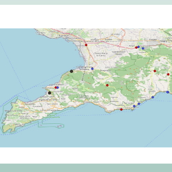
- Road transport network and high speed railway station Vesuvio Est analysis ACaMIR (the Campania Region Agency for Mobility, Infrastructure and Networks) has entrusted the ‘Transport studies related to the accessibility of the Sorrento and Amalfi peninsula starting from the terrestrial transport networks, with particular attention to the Vesuvio est exchange node“ contract to the consortium led by TRTIngegneria srl and composed by Tecnosistem spa and Eng. Antonio Masturzo. The study activities are divided into two lots: • Lot 1A related to the analysis and proposal for the improvement of accessibility to the area of the Amalfi and Sorrento coast, • Lot 1B related to the estimation of the potential demand for access to the Sarnese-Nocerina area also through the construction of a new High Speed rail station in the Striano area. In the transport analysis, conducted as part of Lot 1A, different alternative routes to the current SS145 Sorrentina road were identified in order to reduce the pressure on the heavy trafficked road, that has sections of reduced capacity and with large parts crossing urbanized territory. The results of the model simulations of the various infrastructural scenarios tested and the quantification of the implementation costs were used for the drafting of the cost-benefit analysis and the qualitative and quantitative risk analysis. For Lot 1B, a multimodal simulation model was applied to verify, in light of the introduction of the new High Speed rail Striano station and the reorganization of public transport lines feeding the new intermodal node, the demand potentially attracted by the new structure of the area’s mobility. For the analysis of the area long-distance potential demand, big data from mobile phones were used to identify the movements of origin and destination that currently already use the long-distance railway network to access the railway stations of Naples and Salerno.
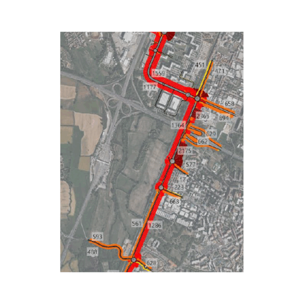
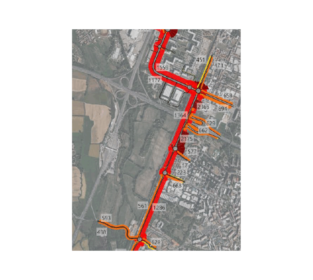
- Preliminary Mobility Study: PA1 and AT1 Development areas TRT supported the identification of transport and infrastructure solutions required to ensure the sustainable development of the PA1 – North Development Area and AT1 – South Development Area in the Municipality of Rozzano (MI). The study assessed the impacts of the planned urban developments on both the road network and public transport system, identifying the most effective measures to maintain adequate accessibility and operational performance. TRT’s activities included: • analysing the existing transport supply, including the road network, public transport services, cycling infrastructure, and multimodal accessibility; • carrying out a comprehensive traffic survey campaign using radar equipment and video monitoring to collect traffic flows and turning-movement data at key intersections; • updating origin-destination matrices and calibrating a dynamic traffic microsimulation model developed using PTV Vissim software; • estimating the mobility demand generated by the new developments and testing alternative infrastructure scenarios; • evaluating public transport enhancement measures to support the future urban expansion areas. The analyses highlighted a transport network already operating close to capacity, with more than 29,000 vehicles per day on the SP35 corridor and approximately 9,000 vehicles during peak hours. The combined development of PA1 and AT1 is expected to generate more than 1,050 additional vehicles during peak periods, making targeted infrastructure upgrades necessary to preserve network performance. The simulations identified the construction of a grade-separated flyover connecting the SP35 corridor and Via Gran San Bernardo as the preferred solution, complemented by road network improvements and public transport enhancements. This scenario would reduce average delays by up to 60%, increase average travel speeds, and maintain satisfactory levels of service across the study area. Through extensive field surveys, advanced transport modelling, and scenario-based assessments, TRT provided the client with a comprehensive technical framework to support the development of the new urban districts, ensuring efficient, accessible, and sustainable mobility conditions over the long term.
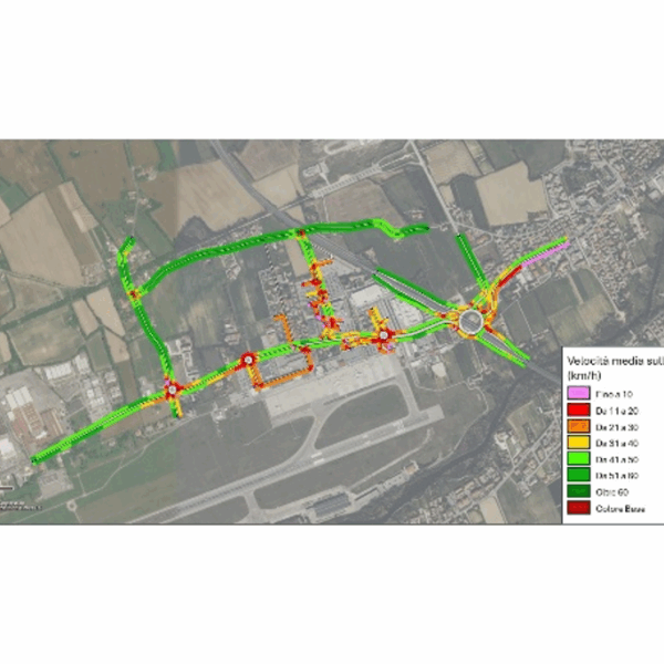
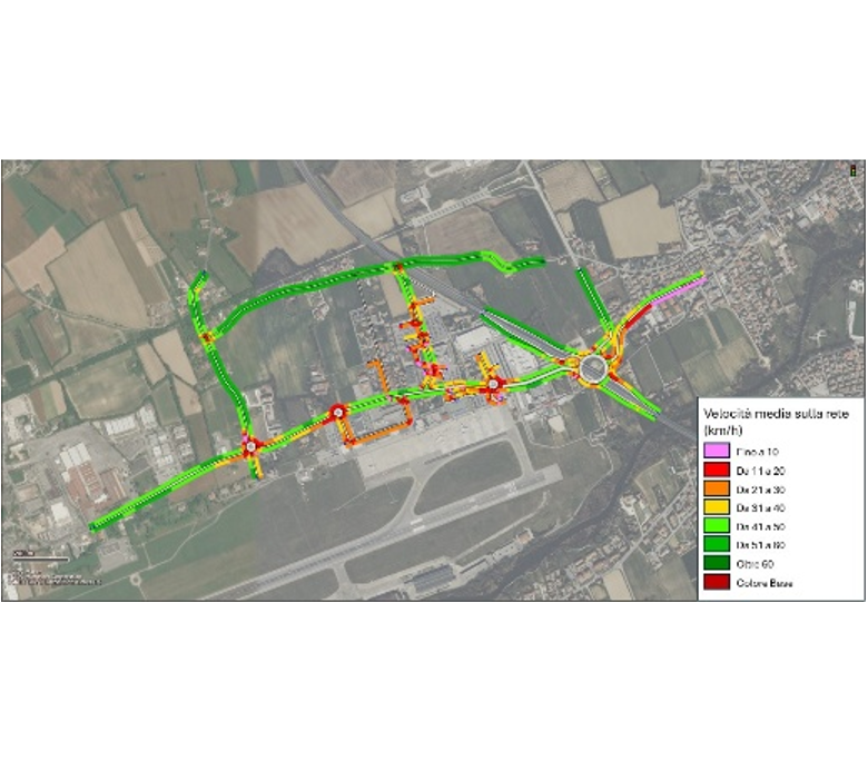
- Mobility Study for the 2040 Master Plan The project supported the development of the Treviso Antonio Canova Airport Masterplan 2040 through the assessment of the transport and traffic impacts associated with the airport’s future growth. The study examined airport accessibility, the performance of the surrounding road network, and the capacity of existing infrastructure to accommodate future mobility demand, identifying the most effective solutions to ensure safe and efficient operations. TRT’s activities included: • analysing the existing transport supply, including the road network, intersections, public transport services, parking facilities, and cycling connections; • carrying out an extensive mobility survey campaign through automatic traffic counts, intersection turning-movement surveys, and passenger mobility questionnaires; • reconstructing travel demand patterns and origin-destination matrices for the study area; • developing future scenarios related to airport traffic growth and the infrastructure measures proposed within the Masterplan; • designing and calibrating a dynamic traffic microsimulation model using PTV Vissim to assess the operational performance of future scenarios. The analyses highlighted the strategic role of the SR 515 Noalese corridor and the SR 53 ring road in providing access to the airport, enabling a detailed assessment of the impacts of alternative design solutions on traffic operations, intersection performance, and parking accessibility. The study also identified targeted recommendations to improve integration with public transport services, enhance cycling accessibility, and optimize airport access management. Through extensive field surveys, advanced transport modelling, and scenario-based assessments, TRT provided SAVE Group with robust technical support for the definition of the Masterplan 2040, contributing to the planning of a sustainable, efficient, and well-integrated airport development strategy.
- EIT Urban Mobility Impact Assessment The study on “Impact Assessment and Framework” was carried out in 2025 with the purpose of developing an Impact Assessment Framework that includes tools and methodologies to evaluate the impact of EIT Urban Mobility activities at three levels: (i) City and Regional, (ii) Project and Portfolio and (iii) Business Areas. The first part of the work consisted in the assessment of three relevant City Impact Indicators in different EIT UM key city partners. The tool provides detailed guidelines through dedicated templates for the calculation of three City Impacts Indicators: i. Road space reallocation to public space ii. City Club city inhabitants exposed to emissions in urban areas iii. Modal share of sustainable mobility. The second part included the assessment of the social, environmental and economic impacts of Innovation projects for the EIT Urban Mobility Business Plan 2023-2025. The main purpose is to develop a guided process for the fulfilment of the necessary evaluation steps for the evaluation of the projects. The Framework is composed by a Word document, which serves as a guidance, and a user-friendly online interactive tool to guide and support the preparation of a well-structured evaluation of innovative urban mobility projects. A total of 91 projects have been assessed, involving four different calls launched by EIT Urban Mobility (Main Call, SME Call, City RAPTOR Call and Targeted Call) during its 2023-2025 Business Plan. The Framework identified for each project different expected impacts and indicators, to measure the effectiveness of the solutions. The framework included: Lastly, the work enabled the implementation of a Monitoring, Evaluation and Learning (MEL) framework for the assessment of EIT UM’s organizational impacts across all core activity areas of their business areas.
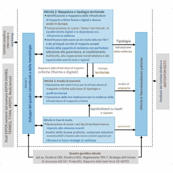
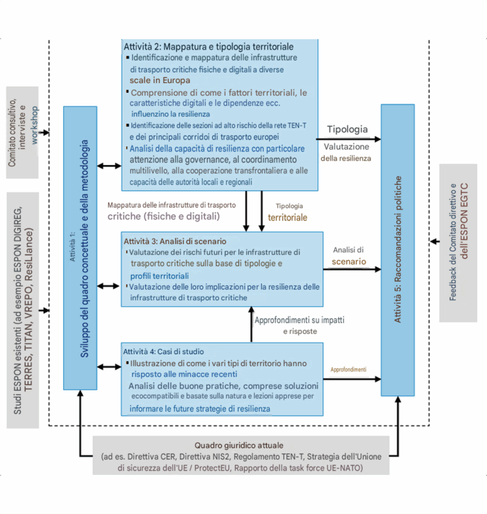
- Territorial outlook on the resilience of critical transport infrastructure across European regions (TRANSITOR) TRANSITOR is a 21-month project funded by European Regional Development Fund (ERDF) (2021/2027) under ESPON 2030 Programme. The objective of the project is to provide evidence-based guidance to policymakers at all geographical levels to enhance the security and resilience of Europe’s critical physical and digital transport infrastructure with a specific focus to consider territorial characteristics. TRT leads Task 2: Mapping & Territorial typology • Mapping physical and digital critical transport infrastructure – TENT elements, data centers, control and traffic management centers, etc. • Analysis of the relevant EU legislation (in particular Directive 2022/362 on the charging of vehicles and Directive 2019/520 on the European Electronic Toll Service); • Developing territorial typology at NUTS3 level – considering infrastructure function (hub, connector, gateway), spatial features (centrality/peripherality), exposure to threats/hazards (natural: floods, heatwaves, wildfires, sea-level rise; technological: cyberattacks, disinformation, and geopolitical) and institutional capacity and resilience • Classification of critical transport infrastructure – development of composite indicators • Deliverable – NUTS3 maps and dataset containing raw and composite indicators TRT will have contributing role in all other tasks, especially in Task 4: Case studies and Task 5: Policy recommendations.
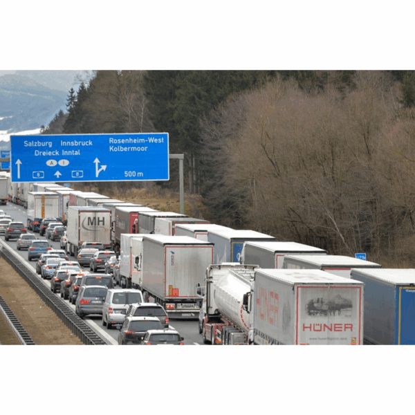
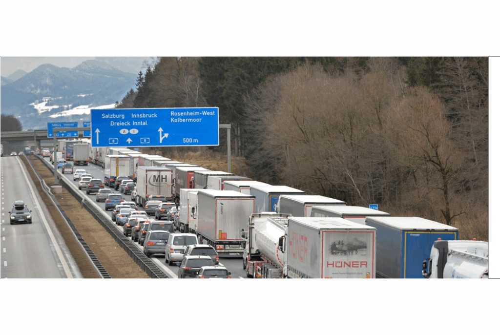
- Technical and legal feasibility study of a variable toll system along the Brenner axis TRT, in collaboration with M-five and supported by a legal team, has been commissioned by the Province of Bolzano to assess the legal and technical feasibility of a variable toll system on freight vehicles along the entire Brenner axis from Munich to Verona, or on individual motorway sections (A22, A13, A12, and A93 The project will carry out: • Analysis of the national legislation applied and applicable in the three countries concerned (AT, DE, IT); • Analysis of the relevant EU legislation (in particular Directive 2022/362 on the charging of vehicles and Directive 2019/520 on the European Electronic Toll Service); • Analysis of the current application by the responsible Authorities in the three countries concerned (AT, DE, IT), any implementation gaps within the scope of the study, and alignment hypotheses; • Analysis of potential legislative obstacles to the application, within the three countries concerned, of a variable toll based on traffic conditions and environmental criteria, alongside a potential digital traffic management system; hypotheses for overcoming obstacles, if any; • Analysis of the various toll technologies currently available to motorway operators in order to identify any necessary technical adjustments or infrastructure required for the introduction of variable tolls according to different possible scenarios; • Conducting interviews with operators and trade associations to estimate the elasticity of demand to tariff changes; • Analysis of the expected impacts resulting from the change in use of the motorway infrastructure during the day or year.
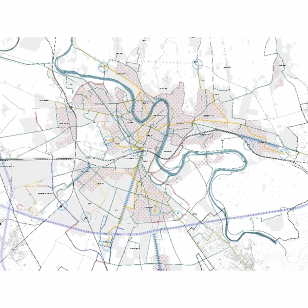
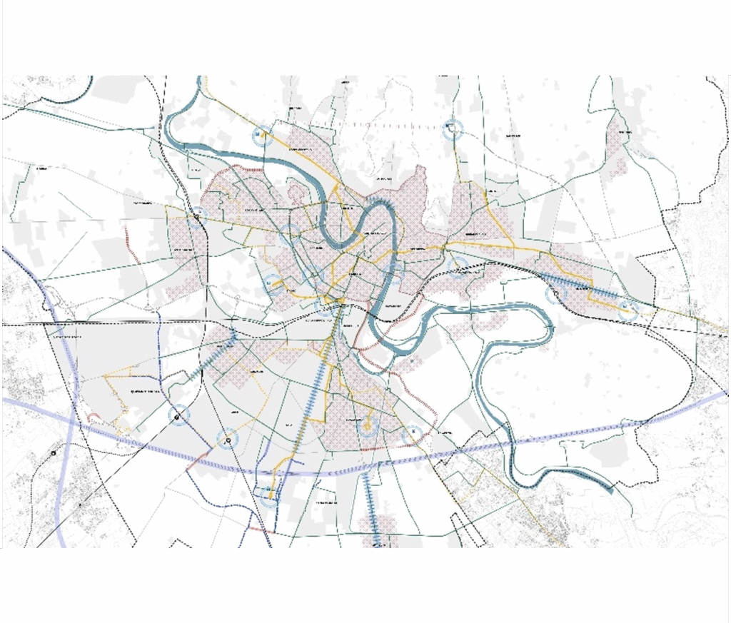
- Drafting of a strategic Masterplan for the City of Verona: transportation aspects and specialized consultancy in the drafting activities of the new Territorial Plan TRT Trasporti e Territorio was appointed by the Municipality of Verona to support the preparation of the strategic Masterplan and project guidelines for the city’s mobility system. In addition to drafting the Masterplan, TRT provides methodological, specialist and operational support throughout the different phases of preparation and approval of the PAT, the Territorial Planning Plan. The specialist activities began with an initial knowledge-building phase, preparatory to the definition of the Masterplan and aimed at reconstructing the reference framework. This phase included an analysis of the current mobility and transport system in the study area, as well as a process of consultation and engagement with key stakeholders. Based on the analyses carried out, the strategic Masterplan for the City of Verona was developed through a comparative assessment of infrastructure interventions, aimed at defining their relevance, consistency with the plan objectives and implementation priority. This work led to the preparation of the specialist contribution on mobility and transport within the PAT, including the infrastructure framework map supporting the city’s urban development. The Preliminary PAT Document was adopted by the Municipal Executive Committee on 30 December 2024. The second phase of activities focused, on the one hand, on the technical assessment of selected road network solutions, developed as part of a multidisciplinary process with the other professionals involved in the PAT and supported by the use of a traffic simulation tool to analyse different road traffic scenarios. On the other hand, this phase included the preparation of specific integrated project masterplans for each quadrant or sensitive area of the city. The PAT, in its version ready for approval, has now been delivered to the Municipal Administration.
- External support study on the connectivity of major TEN-T airports by long-distance rail Connectivity of major TEN-T airports by long distance trains will bring the EU closer together, advancing the decarbonization of transportation, and enhancing competitiveness and business productivity by reduction in the travel time, increase in the catchment areas, reduction in greenhouse gas emissions and air pollution by providing a viable alternative to travel by air or road and bringing about a modal shift. The overall objective of the study is to provide the European Commission with a robust assessment of the situation of the major EU airports in terms of their connectivity to the TEN-T network by rail long-distance, incl. HSR. The measures needed to enhance the rail usage and the main obstacles will also be identified. Furthermore, the study will analyse the investment gaps and priorities to enable the Commission to draw relevant conclusions in the context of the upcoming MFF, with a focus on the most important actions in terms of effectiveness. The study should also serve as a reference document for national authorities, to inform their investment decisions (best practices). The study will focus on at least 32 European airports: • 20 airports above 12 million passengers averaged over the period 2021 until 2023, • 10 airports below 12 million passengers but recently revealing strong demand growth, • 2 or more newly planned airports (so far in Lisbon and Warsaw new airports have been identified).