- All
- African projects
- assessment
- assessment selected projects
- Assessment selected projects 2
- Assessment selected projects 3
- Assessment selected projects 4
- ASTRA
- Cost Benefit Analysis
- Electric mobility and ITS
- Local Public Transport
- MOMOS
- planning
- planning selected projects
- planning selected projects 2
- planning selected projects 3
- planning selected projects 4
- planning selected projects 5
- projects
- Railways projects
- research
- research selected projects
- research selected projects 2
- research selected projects 3
- studies
- studies selected projects 1
- studies selected projects 2
- studies selected projects 3
- studies selected projects 4
- studies selected projects 5
- TRTingegneria
- TRUST
- urban mobility
- Poggiardo AI SMART: Identification and characterisation of cycle tourism routes in the Idruntine hinterland AISmart (Adriatic Ionian Small Port Network) is a strategic project of the Interreg Italy-Greece Programme, coordinated by the Apulia Region, which aims at the implementation and development of a common port network in the Adriatic-Ionian area based on the concept of “smart, green and integrated port” and which has among its objectives the enhancement of the natural and landscape resources of the hinterland. The Municipality of Poggiardo, leader of a grouping of 18 municipalities in the idruntina area that participating in the project, has entrusted TRT with the identification and the characterisation of cycling routes for the fruition of the inner territory and the coastline. The activities conducted have concerned: The network and itineraries identified have been described through maps and GPX tracks as well as by “travel stories” and videos for inclusion in the AI Smart platform.
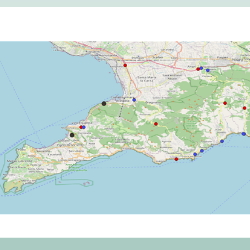
- Road transport network and high speed railway station Vesuvio Est analysis ACaMIR (the Campania Region Agency for Mobility, Infrastructure and Networks) has entrusted the ‘Transport studies related to the accessibility of the Sorrento and Amalfi peninsula starting from the terrestrial transport networks, with particular attention to the Vesuvio est exchange node“ contract to the consortium led by TRTIngegneria srl and composed by Tecnosistem spa and Eng. Antonio Masturzo. The study activities are divided into two lots: • Lot 1A related to the analysis and proposal for the improvement of accessibility to the area of the Amalfi and Sorrento coast, • Lot 1B related to the estimation of the potential demand for access to the Sarnese-Nocerina area also through the construction of a new High Speed rail station in the Striano area. In the transport analysis, conducted as part of Lot 1A, different alternative routes to the current SS145 Sorrentina road were identified in order to reduce the pressure on the heavy trafficked road, that has sections of reduced capacity and with large parts crossing urbanized territory. The results of the model simulations of the various infrastructural scenarios tested and the quantification of the implementation costs were used for the drafting of the cost-benefit analysis and the qualitative and quantitative risk analysis. For Lot 1B, a multimodal simulation model was applied to verify, in light of the introduction of the new High Speed rail Striano station and the reorganization of public transport lines feeding the new intermodal node, the demand potentially attracted by the new structure of the area’s mobility. For the analysis of the area long-distance potential demand, big data from mobile phones were used to identify the movements of origin and destination that currently already use the long-distance railway network to access the railway stations of Naples and Salerno.
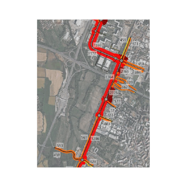
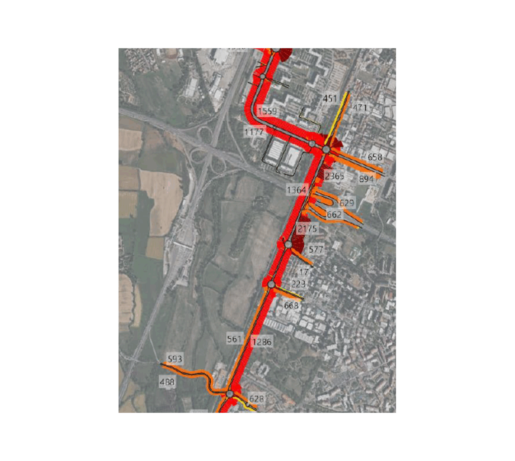
- Preliminary Mobility Study: PA1 and AT1 Development areas TRT supported the identification of transport and infrastructure solutions required to ensure the sustainable development of the PA1 – North Development Area and AT1 – South Development Area in the Municipality of Rozzano (MI). The study assessed the impacts of the planned urban developments on both the road network and public transport system, identifying the most effective measures to maintain adequate accessibility and operational performance. TRT’s activities included: • analysing the existing transport supply, including the road network, public transport services, cycling infrastructure, and multimodal accessibility; • carrying out a comprehensive traffic survey campaign using radar equipment and video monitoring to collect traffic flows and turning-movement data at key intersections; • updating origin-destination matrices and calibrating a dynamic traffic microsimulation model developed using PTV Vissim software; • estimating the mobility demand generated by the new developments and testing alternative infrastructure scenarios; • evaluating public transport enhancement measures to support the future urban expansion areas. The analyses highlighted a transport network already operating close to capacity, with more than 29,000 vehicles per day on the SP35 corridor and approximately 9,000 vehicles during peak hours. The combined development of PA1 and AT1 is expected to generate more than 1,050 additional vehicles during peak periods, making targeted infrastructure upgrades necessary to preserve network performance. The simulations identified the construction of a grade-separated flyover connecting the SP35 corridor and Via Gran San Bernardo as the preferred solution, complemented by road network improvements and public transport enhancements. This scenario would reduce average delays by up to 60%, increase average travel speeds, and maintain satisfactory levels of service across the study area. Through extensive field surveys, advanced transport modelling, and scenario-based assessments, TRT provided the client with a comprehensive technical framework to support the development of the new urban districts, ensuring efficient, accessible, and sustainable mobility conditions over the long term.
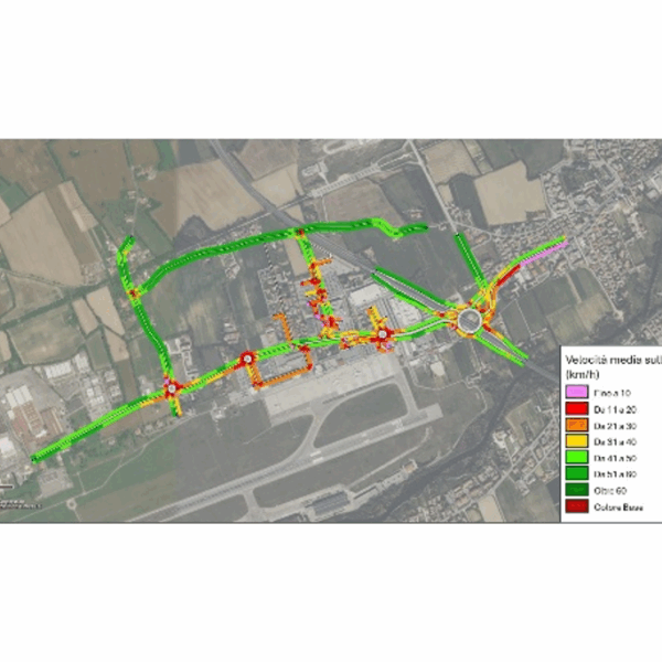
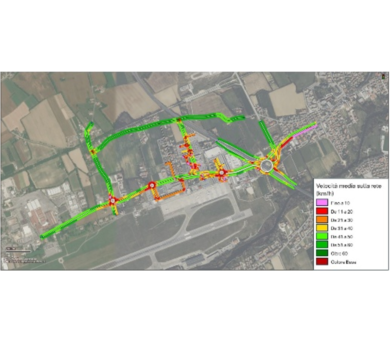
- Mobility Study for the 2040 Master Plan The project supported the development of the Treviso Antonio Canova Airport Masterplan 2040 through the assessment of the transport and traffic impacts associated with the airport’s future growth. The study examined airport accessibility, the performance of the surrounding road network, and the capacity of existing infrastructure to accommodate future mobility demand, identifying the most effective solutions to ensure safe and efficient operations. TRT’s activities included: • analysing the existing transport supply, including the road network, intersections, public transport services, parking facilities, and cycling connections; • carrying out an extensive mobility survey campaign through automatic traffic counts, intersection turning-movement surveys, and passenger mobility questionnaires; • reconstructing travel demand patterns and origin-destination matrices for the study area; • developing future scenarios related to airport traffic growth and the infrastructure measures proposed within the Masterplan; • designing and calibrating a dynamic traffic microsimulation model using PTV Vissim to assess the operational performance of future scenarios. The analyses highlighted the strategic role of the SR 515 Noalese corridor and the SR 53 ring road in providing access to the airport, enabling a detailed assessment of the impacts of alternative design solutions on traffic operations, intersection performance, and parking accessibility. The study also identified targeted recommendations to improve integration with public transport services, enhance cycling accessibility, and optimize airport access management. Through extensive field surveys, advanced transport modelling, and scenario-based assessments, TRT provided SAVE Group with robust technical support for the definition of the Masterplan 2040, contributing to the planning of a sustainable, efficient, and well-integrated airport development strategy.
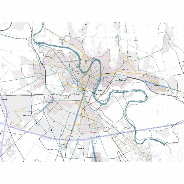
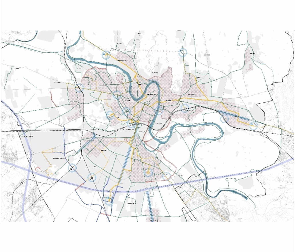
- Drafting of a strategic Masterplan for the City of Verona: transportation aspects and specialized consultancy in the drafting activities of the new Territorial Plan TRT Trasporti e Territorio was appointed by the Municipality of Verona to support the preparation of the strategic Masterplan and project guidelines for the city’s mobility system. In addition to drafting the Masterplan, TRT provides methodological, specialist and operational support throughout the different phases of preparation and approval of the PAT, the Territorial Planning Plan. The specialist activities began with an initial knowledge-building phase, preparatory to the definition of the Masterplan and aimed at reconstructing the reference framework. This phase included an analysis of the current mobility and transport system in the study area, as well as a process of consultation and engagement with key stakeholders. Based on the analyses carried out, the strategic Masterplan for the City of Verona was developed through a comparative assessment of infrastructure interventions, aimed at defining their relevance, consistency with the plan objectives and implementation priority. This work led to the preparation of the specialist contribution on mobility and transport within the PAT, including the infrastructure framework map supporting the city’s urban development. The Preliminary PAT Document was adopted by the Municipal Executive Committee on 30 December 2024. The second phase of activities focused, on the one hand, on the technical assessment of selected road network solutions, developed as part of a multidisciplinary process with the other professionals involved in the PAT and supported by the use of a traffic simulation tool to analyse different road traffic scenarios. On the other hand, this phase included the preparation of specific integrated project masterplans for each quadrant or sensitive area of the city. The PAT, in its version ready for approval, has now been delivered to the Municipal Administration.
- Boosting regional economic development in the Balkans with the “Giro di Ciro” Greenway “The “Giro di Ciro” was a transnational greenway project in the Western Balkans, commissioned by the World Bank to support governments in the region, with a specific focus on Bosnia and Herzegovina, in moving the project from concept towards implementation. It aimed to convert the historic Belgrade-to-Adriatic narrow-gauge railway, developed between the 1800s and 1900s, into a pedestrian and cycling greenway of more than 800 km across Serbia, Bosnia and Herzegovina, Croatia and Montenegro. The assignment focused on the Bosnian section and included the following activities: • Defining a shared transnational vision and narrative for the Giro di Ciro corridor, supported by a cost-benefit analysis and an assessment of its tourism and economic potential, later translated into a promotional brochure and communication materials; • Proposing a National Greenway Framework for the development, governance and management of a greenway network in Bosnia and Herzegovina, including the Giro di Ciro, discussed with key national institutions; • Preparing a Preliminary Study for a priority 150 km section in Bosnia and Herzegovina, based on an assessment of the former railway corridor and its territorial context; • Engaging institutional and local stakeholders and disseminating project results, including the organisation of a final high-level conference in Sarajevo. During the Sarajevo Cycling Forum, organised by TRT on 3 June as the final project event and hosted by UNESCO at the United Nations venue in Sarajevo, the Giro di Ciro route was approved for integration into the TEN-T EuroVelo network promoted by ECF as EuroVelo 21. This recognition confirmed the international relevance of the corridor and provided a basis for the future development. Through this work, TRT strengthened its expertise in transnational greenway planning, cycle tourism, stakeholder coordination and the reuse of disused railway corridors as active mobility infrastructure, developing approaches applicable to similar future projects.
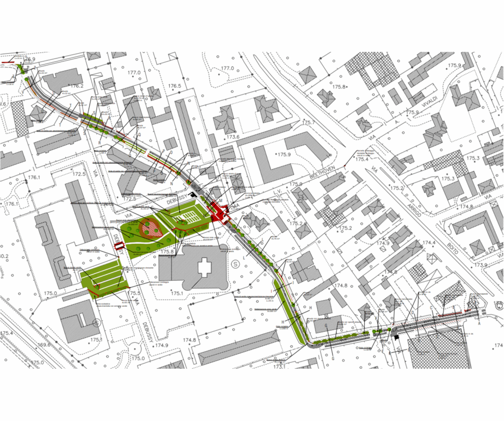
- Drafting of a Technical and Economic Feasibility Study (PFTE) for a cycle path along Via della Birona in Monza TRTIngegneria was commissioned by architect Andrea Nonni to assist in the preparation of project design documents for the Municipality of Monza’s participation in the Lombardy Region’s ‘Strade Verdi’ (Green Roads) tender. Specifically, the contribution is required for the drafting of the PFTE (Preliminary Technical Project) of a cycle path along Via della Birona in Monza, Italy and the related works for its inclusion in the areas in front of the entrance to the nursery and primary schools in Via Debussy. The project involved the construction of a one-way cycle path along the entire length of Via della Birona, divided into two sections (one one-way northbound in the southern part and one southbound in the northern part of Via Beethoven). The infrastructure integration work included: • the renovation of the car park along Via della Birona, with the use of draining paving and devices for groundwater filtration; • the implementation of speed reduction measures along Via della Birona and Via Debussy, through the construction of a speed bump at the intersection with Via Beethoven and a raised crossing on Via Debussy; • the construction of new paving for the parking areas in front of schools that allows rainwater to filter through, including a filter tank; • green spaces with plants capable of filtering atmospheric pollutants, accompanied by a playground, pedestrian areas serving schools to improve their accessibility, together with bicycle parking facilities (racks), benches and other street furniture.
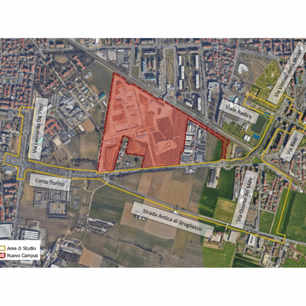
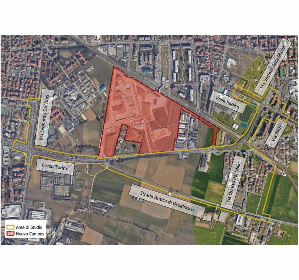
- Assessment of the impact on traffic of the opening of the new campus of the University of Turin, ‘Città delle Scienze e dell’Ambiente’ (City of Science and Environment), located in Grugliasco, Metropolitan City of Turin TRT was chosen by Zona Ovest di Torino srl to provide modelling support in defining the impact of the new campus of the University of Turin, ‘Città delle Scienze e dell’Ambiente’ (City of Science and Environment), in the municipality of Grugliasco. The new campus includes facilities for the Chemistry and Biology Departments, spaces for research, teaching and ancillary services for students, covering a total of approximately 90.000 m2 and is expected to double the university population (from the current 5,000 to approximately 10,000). The study begins with the VISUM model developed by TRT on behalf of Zona Ovest and the Municipality of Grugliasco as part of the support assignment for the evaluation of the PGTU, further refining its calibration through a traffic detection campaign. The macroscopic model was used for the municipal-scale assessment of the opening of the new campus, while the local impact assessment was carried out using a dynamic microscopic simulation model in the VISSIM environment. The study took into account various data sources, in addition to ad hoc surveys, of a demographic and statistical nature on the student population and university staff involved in the transfer (keeping teachers separate from researchers, research fellows, scholarship holders, technical and administrative staff, etc.) as well as information on the current travel habits of people who already gravitate towards Grugliasco (where the veterinary, agrovet, agricultural and “agrinnova” facilities are located), including modes of transport, weekly campus attendance, the number of years students are behind in their studies, and the location of their domicile or residence. The analyses carried out have made it possible to identify the configuration and adaptation measures for the road network that are most effective in mitigating the impact of the opening of the university campus.
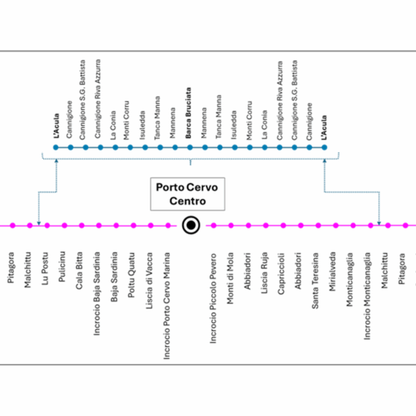
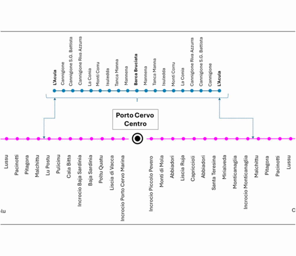
- Design and technical assistance for the award of the Local Public Transport service of the Municipality of Arzachena The Municipality of Arzachena entrusted TRT with the service of “Design and technical assistance for the award of the Local Public Transport service of the Municipality of Arzachena”. The assignment involves activities aimed at the design and assistance for the awarding of the Local Public Transport (LPT) service contract for the Municipality of Arzachena. The work is structured into three main phases: •Preliminary territorial and transport analysis, aimed at understanding the territorial dynamics and the characteristics of the existing service; •Planning and design of the public transport service, consisting of the definition of the characteristics of the proposed public transport service; •Technical assistance to the procedures for the selection and award of the service, consisting of technical support to the Municipality for the preparation of the tender documents and for all phases of the award procedure. The first phase of analysis aims to reconstruct the current framework of local mobility, considering the settlement, demographic and tourist characteristics of the municipal area, as well as analysing transport demand through specific investigations. The second phase is based on the results of the knowledge framework reconstruction to develop a new transport offer configuration, consistent with the mobility needs of the different user groups, both in summer (tourists) and winter (residents), distinguishing between annual service, seasonal summer service and any flexible services. The activities also include technical assistance to the Municipality of Arzachena in the preparation of the special tender specifications, the tender rules and the service contract scheme. To date, TRT has completed the preliminary territorial and transport analysis.