- All
- African projects
- assessment
- assessment selected projects
- Assessment selected projects 2
- Assessment selected projects 3
- Assessment selected projects 4
- ASTRA
- Cost Benefit Analysis
- Electric mobility and ITS
- MOMOS
- planning
- planning selected projects
- planning selected projects 2
- planning selected projects 3
- planning selected projects 4
- planning selected projects 5
- projects
- Railways projects
- research
- research selected projects
- research selected projects 2
- research selected projects 3
- studies
- studies selected projects 1
- studies selected projects 2
- studies selected projects 3
- studies selected projects 4
- studies selected projects 5
- TRTingegneria
- TRUST
- urban mobility
- Exploratory study for the new proposal addressing market challenges for the development of Multimodal Digital Mobility Services and the Single Digital Booking And Ticketing Regulation The main objective of the study is to support the development of the European Commission’s proposals for two parallel and complementary regulations: The focus of the study is on medium-long distance passenger trips, above 50 km. The activities will include at first the market analysis on the two aspects covered by the study. On the MDMS demand side, existing and potential demand for the use of MDMS services will be explored, while on the supply side, the presence, practical availability and accessibility of options across the EU will be assessed through the analysis of 100 representative routes. Passenger transport services and online passenger ticketing will be analysed for different modes of transport: air passenger transport (including Norway), rail passenger transport, bus and coach transport and maritime transport. Based on the analysis, the study will also define different policy options and support the assessment of the related impacts through the application of a modelling framework consisting of 6 modules, including the strategic ASTRA model. Impacts on passenger choice and resulting modal shifts will be estimated together with the resulting environmental, economic and social indicators by Member State and in 5 year steps up to 2050. The Consortium is lead by RICARDO, including TRT, TIS and TEPR. TRT contributes to the project as it comes to:
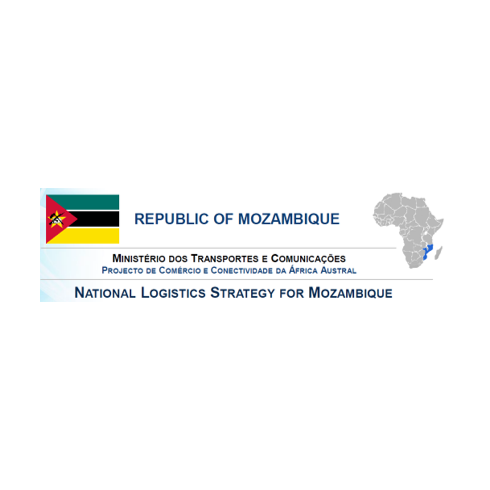
- The National Logistics Strategy for Mozambique was committed to a consortium coordinated by IdeaConsult and involving TRT and EEPLAN (a company located in Mozambique). The main objectives of the assignment are: The assignment will be carried out in four stages according to the following:
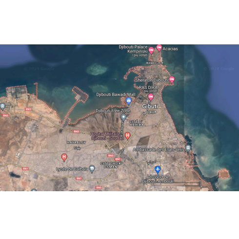
- The Djibouti authorities have appointed the consortium led by IDEA Consult to develop a long-term vision for urban mobility and an action plan for the short, medium and long term, taking into account climate change and its impact on transport networks. The aim of the project is to address the problems of the capital’s transport system, which are undermining its functionality. The study will be carried out in three phases An initial diagnostic phase of the urban transport system, which includes analysing demand, surveying the current state of the road infrastructure and constructing a macro and micro model. A second phase consisting of two main activities: a short-term priority investment programme providing rapid responses to problems, and the development of a shared long-term strategic vision for the urban transport system. Finally, a third phase will be the definition of the master plan for the urban road system. Within the consortium TRT will be responsible for:
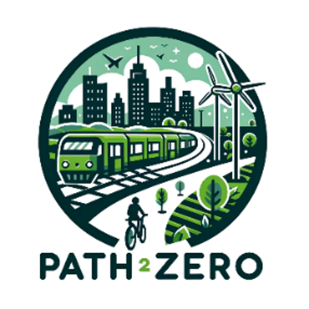
- Accelerating net-zero transformation by advancing Europe’s transport pathways and cross-sectoral synergies, with the assessment through a system dynamic modelling framework of current plans and the design of alternative pathways PATH2ZERO aims to provide a comprehensive knowledge base for developing, evaluating and benchmarking net-zero transport pathways, including cross-sectoral assessments and fostering global collaboration. The transport sector accounts for a third of total greenhouse gas (GHG) emissions in the EU, and current planned policies (at EU and national level) alone are expected not be sufficient to meet these targets. Accordingly, there is a need to “develop a new post-2030 energy and climate policy framework to implement the 2040 GHG ambition level” as well as to achieve net-zero GHG emissions by 2050. The project will first develop a common analytical framework for the description of national pathways, with a focus on transport-related content, to collect comparable descriptions of implemented and planned cross-sectoral mitigation plans and transport policy pathways, as well as data for each EU Member State. An interactive dashboard will provide an overview of the current policy frameworks in the EU Member States related to the decarbonisation of the transport sector, facilitating comparative analysis. An advanced modelling framework (STraDyM – Transport Strategies Dynamic Model) will be designed and developed to forecast transport sector activity and emissions up to 2050 at Member State level, integrating them with other sectors for in-depth GHG mitigation assessments, including equity and economic impacts. Existing national transport models (available in five countries) will complement the framework. Finally, the PET-VTT model will be used to model the national and EU level pathways and strategies, including all the energy sectors and mitigation of CO2 emissions (taking transport-related input from the StraDyM and national models). The modelling framework will allow to assess whether the pathways currently implemented and planned in national strategies are likely to achieve the target reduction on the national level, what impact these strategies bear in terms of fairness, costs and risks. Finally, alternative pathways will be designed and simulated, highlighting all target and pathway choices and their trade-offs to evaluate and assess their impacts and effectiveness. The Consortium is led by DLR (Germany), including TRT and 10 other partners from Finland, Spain, Greece, Hungary, Germany, UK, Norway, France, Italy. TRT contributes to the project as it comes to:
- Drafting of the new Sustainable Urban Mobility Plan and updating of the General Urban Traffic Plan for the city of Udine After a tender process, TRTIngegneria, in partnership with ISFORT Istituto Superiore di Formazione e Ricerca per i Trasporti, Ambiente Italia and GVG Engineering, was selected by the Municipality of Udine to draft the city’s first Sustainable Urban Mobility Plan (SUMP) and update its General Urban Traffic Plan (PGTU). With regard to the PUMS, the working group’s activities are structured according to the following methodological steps, in line with the 2019 guidelines of the Ministry of Transport and the new Regulation (EU) 2024/1679 (the city of Udine is a TEN-T urban node): All phases are accompanied by a broad and structured communication and participation campaign, which involves citizens and stakeholders through public meetings, technical round tables, focus groups and online questionnaires. The PGTU is developed on the basis of the objectives and measures defined in the short-term scenario of the PUMS, detailing the characteristics and feasibility of the individual actions. During the drafting of the PGTU, a series of urban traffic nodes are subject to detailed assessment through the application of a micro-dynamic simulation model (VISSIM) integrated with the multimodal model developed for the PUMS.
- Port of Livorno and Interporto Vespucci – Development and interaction between the Rail Plan and Darsena Europa The study, developed on behalf of Vega Engineering for the AdSP of the Northern Tyrrhenian Sea, was aimed at the functional analysis of the port – freight village system in the Livorno area to assess its potential and opportunities following the realisation and full implementation of the Piano del Ferro and the Darsena Europa. To this end, a cognitive framework was defined on the characteristics of supply and demand, current and future, of the port-freight village system and the definition of the functional evolution of the system in relation to the realisation of the planned infrastructural interventions around it. To support the definition of the port and freight village system, an analysis of the main Italian freight villages was also carried out in order to identify their characteristics, good practices and strong points to be transferred, if necessary, to the specific context of Livorno. Following the definition of the evolutionary scenarios, the infrastructural potential of the intermodal terminal was verified, and the future prospects of the entire port-freight village system were assessed, integrating this activity with the support of a simplified economic-financial analysis for the various evolutionary scenarios.
- Support for studies and research on demand and supply of taxi services in the Lombardy airports area The study consists of an analysis of the demand and supply of taxi services in the Lombardy Airport Basin. The overall objective of the study is to contribute to the definition of the appropriate level of taxi service in the Basin and the consequent determination of the number of licences required to provide this service. The study consists of several activities.The first activity is a sector study aimed at reconstructing elements regarding the supply context (mainly the regulatory framework) and potential demand for mobility in relation to taxi services. The second, and main, activity is a sample survey of Stated Preference to analyse the importance of several variables inherent to the taxi service and competition with alternative modes. The survey is conducted by means of a web-based questionnaire (CAWI) on a sample of 850 residents in Lombardy and 250 residents in other regions. For each respondent, the questionnaire includes some introductory questions and two different Stated Preferences exercises. The third activity is a fieldwork analysis of the interaction between demand and supply of services at a sample of taxi parking areas. The purpose of the survey, repeated annually for the three years of the study, is to analyse the main dynamics related to car parking times, customer waiting times, average number of customers per ride and other elements. The fourth activity consists of setting up a monitoring system for the taxi service. This includes the definition of a list of indicators and procedures for their quantification (data collection and processing) TRT develops all the activities of the study, except for the operational execution of the surveys, which is taken care of by companies identified directly by Polis. However, TRT takes care of the definition of the survey instruments (questionnaire) and the sample.
- Assess the degree of the implementation of the ‘user pays’ and the ‘polluter pays’ principles in the transport field in the EU Member States and other developed countries The objective of the study is to assess the extent to which the “user pays” and the “polluter pays” principles are implemented in the transport field. This allows the European Commission to observe the progress of Member States towards the goal of full internalisation of external and infrastructure costs of transport and to identify options for further internalisation. This study is an update of previous studies published in the years 2019 and 2014. The scope of the current study is extended to cover all external costs, all transport modes and, geographically, EU27 plus UK, Norway, Switzerland, Turkey, Western Balkans, Iceland, USA (2 States), Canada (2 provinces), Japan, Australia, New Zealand. Specific objectives concern: Provide estimations of total, average and marginal infrastructure and external costs for all relevant modes/vehicle categories and countries. Provide a detailed and transparent overview of the transport-related taxes and charges, including their structure and revenues, for all relevant modes/vehicle categories and countries. Assess the application for the different transport modes in the relevant countries of both the user-pays and polluter-pays principles. The update of the Handbook on External costs The objectives of the study are achieved through a comprehensive data collection on infrastructure costs (i.e., investment, renewal and operating), transport charges, earmarking of tax revenues and user charges. Appropriate methodologies are applied to estimate external costs for all modes and categories. With regard to the activities of the study, TRT (already involved in previous studies) is responsible for: developing estimates of the external costs related to congestion for all transport modes, developing estimates of infrastructure costs for rail mode and with regard to all categories of external costs elaborating the analysis of six case studies on intermodal freight terminals, and supporting data collection, as country expert for Italy, France, Poland, Latvia and Lithuania. For more information, check our previous study on Sustainable Transport Infrastructure Charging and Internalisation of Transport Externalities
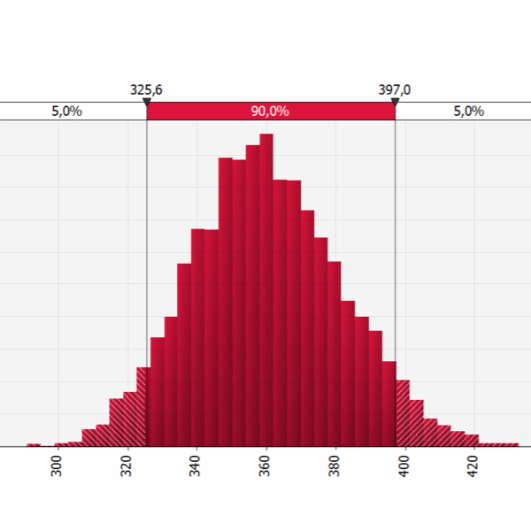
- Feasibility project of the mass transport system for the connection between the area of the railway station located in Latina Scalo and the city centre TRTingegneria as member of the consortium formed by Tecnosistem (leader) and One Works (partner), has been commissioned to draft the Technical and Economic Feasibility Project – PFTE – for the public transport connection between the railway station (located in Latina Scalo) and the city center of Latina. Within the project, TRTIngegneria is responsible for the preparation of the cost-benefit analysis and risk analyses. The Cost-Benefit Analysis evaluates, by comparison, different alternatives of the public transport lines’ routes through the calculation of their main economic indicators (Economic Net Present Value – ENPV and Economic Internal Rate of Return – EIRR). The basic approach of every evaluation is the comparison of different alternative scenarios against the reference scenario of no project implementation. The analysis is conducted considering the MIT Guidelines for the evaluation of investments in public works (2017) and the recent Addendums for the submission of applications for access to resources designated for Rapid Mass Transport by Fixed Installations and for the evaluation of railway projects (2021). As required by the ministerial guidelines, the economic analysis is accompanied by the qualitative risk analysis and the quantitative risk analysis, that has been developed using the specialized software (@Risk). The @Risk software employs Monte Carlo simulation, a statistical technique that involves running multiple simulations using random variables to generate possible outcomes for a decision or event. The quantitative risk analysis is enhanced with sensitivity analysis, scenario analysis, and their optimization. For the main statistical variables (e.g., investment costs, operational costs, benefits, etc.), the software allows choosing from numerous distribution curves and generates numerical and graphic outputs with the calculation of P90 and/or P80 and P50 probabilities for the results of the analyses conducted.


